Gundabooka National Park is located a short drive from Bourke and the Darling River boasts some magnificent examples of Aboriginal Rock Art in addition to three magnificent walks to access different sections of Mt Gundabooka.
Easily accessible off the Kidman way the three main areas of the park provide great walks and picnic locations and the centrally located Dry Tank area provides the visitor with a wonderfully located camping area.
Situated less than 1 hours drive from Bourke on the Kidman Way, Gundabooka National Park provides the traveller with a wonderful place to explore the wonders of the landscape.
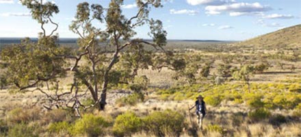
 Bounded to the north by the Darling River, the park has wonderful open plains, a beautiful creek-fed gorge (seasonal), culturally significant rock art and the magnificent mountain after which the park is named – Mt Gundabooka.
The park can be explored by car or by foot as there are three main walking tracks spread over this diverse environment.
There are 3 access points to the horse shoe shaped mountain.
1) Mulgowan (Yapa) Art Site Walk: A wonderful easy trail which allows the visitor to walk across a small rocky bluff and into the Mulareenya Creek full of rock pools river gums and moving rock art on some of the overhangs.
2) Dry Tank: Providing a wonderful setting for camping, the Dry Tank area is also an ideal picnic spot as it is here that the Little Mountain trail provides a wonderful vista of Mt Gundabooka via well marked interpretive walk.
3) Ngama Malyan (Valley of the Eagle): Bennett’s Gorge on the western side of Mt Gundabooka is the starting point for the Valley of the Eagles walking trail. The easy 1 km walk leads to a wonderful picnic spot at the bas of Mt Gubdabooka.
The area of Gundabooka is the country of the Ngemba and Barkinji people. In addition to the area being vital for stone, water, food and medicine; it also hold major significance in terms of ceremony and creation.
Access to the park is via a dry weather road
For more information on Gundabooka National Park – GPS:-30.51312* 145.7099*