The Queensland headwaters of the Darling (the area now known as the Darling Downs) were gradually colonised from 1815 onward.
In 1828 the explorer Charles Sturt and Hamilton Hume were sent by the Governor of New South Wales, Sir Ralph Darling, to investigate the course of the Macquarie River. He discovered the Bogan River and then, early in 1829, the upper Darling, which he named after the Governor. In 1835, Major Thomas Mitchell travelled a 483-kilometre portion of the Darling River. Although his party never reached the junction with the Murray River he correctly assumed the rivers joined.
In 1856, the Blandowski Expedition set off for the junction of the Darling and Murray Rivers to discover and collect fish species for the National Museum. The expedition was a success with 17,400 specimens arriving in Adelaide the next year.
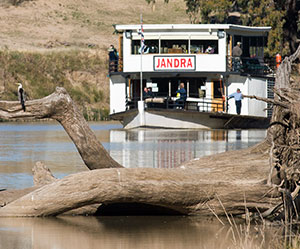
Although its flow is extraordinarily irregular (the river dried up on no fewer than forty-five occasions between 1885 and 1960), in the later 19th century the Darling became a major transportation route, the pastoralists of western New South Wales using it to send their wool by shallow-draft paddle steamer from busy river ports such as Bourke and Wilcannia to the South Australian railheads at Morgan and Murray Bridge. But over the past century the river’s importance as a transportation route has declined.
In 1992, the Darling River suffered from severe cyanobacterial bloom that stretched the length of the river. The presence of phosphorus was essential for the toxic algae to flourish. Flow rates, turbulence, turbidity and temperature were other contributing factors.
In 2008, the Federal government purchased Toorale Station in northern New South Wales for A$23 million. The purchase allowed the government to return 11 gigalitres of environmental flows back into the Darling.
The whole Murray–Darling river system, one of the largest in the world, drains all of New South Wales west of the Great Dividing Range, much of northern Victoria and southern Queensland and parts of South Australia. Its meandering course is three times longer than the direct distance it traverses.
Much of the land that the Darling flows through are plains and is therefore relatively flat, having an average gradient of just 16 mm per kilometre. Officially the Darling begins between Brewarrina and Bourke at the confluence of the Culgoa and Barwon rivers; streams whose tributaries rise in the ranges of southern Queensland and northern New South Wales west of the Great Dividing Range. These tributaries include the Balonne River (of which the Culgoa is one of three main branches) and its tributaries; the Macintyre River and its tributaries such as the Dumaresq River and the Severn Rivers (there are two – one either side or the state border); the Gwydir River; the Namoi River; the Castlereagh River; and the Macquarie River. Other rivers join the Darling near Bourke or below – the Bogan River, the Warrego River and Paroo River.
South east of Broken Hill, the Menindee Lakes are a series of lakes that were once connected to the Darling River by short creeks. The Menindee Lake Scheme has reduced the frequency of flooding in the Menindee Lakes. As a result, about 13,800 hectares of lignum and 8,700 hectares of Black box have been destroyed. Weirs and constant low flows have fragmented the river system and blocked fish passage.
The Darling River runs south-south-west, leaving the Far West region of New South Wales, to join the Murray River on the New South Wales – Victoria border at Wentworth, New South Wales.
The Barrier Highway at Wilcania, the Silver City Highway at Wentworth and the Broken Hill railway line at Menindee, all cross the Darling River. Part of the river north of Menindee marks the border of Kinchega National Park. In response to the 1956 Murray River flood a weir was constructed at Menindee to mitigate flows from the Darling River.
The north of the Darling River is in the Southeast Australia temperate savanna ecoregion and the south west of the Darling is part of the Murray Darling Depression ecoregion.
Major settlements along the river include Brewarrina, Bourke, Louth, Tilpa, Wilcannia, Menindee, Pooncarie and Wentworth. Wentworth was Australia’s busiest inland port in the late 1880s.
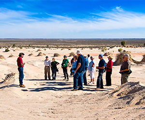
Navigation by steam boat to Brewarrina was first achieved in 1859. Brewarrina was also the location of intertribal meetings for Indigenous Australians who speak Darling and live in the river basin. Ancient fish traps in the river provided food for feasts. These heritage listed rock formations have been estimated at more than 40,000 years old making them the oldest man-made structure on the planet.
Source: Wikipedia