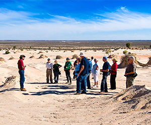
… Outback travel nowadays can be done in the comfort of modern reliable vehicles and the security of modern communication to the ‘outside’ world but spare a thought for how it was done before the country was ‘known’…
We can only imagine how it was done during the early 1800’s … horses and drays, camels and having to carry all supplies for survival, in many cases for over a year; the area was also unexplored and travel was undertaken with little or no bush craft skills and no idea where, when, how and if the suspected water courses flowed.
Such was the character, and naivety, of our early explorers and those who sent them out there.
George Evans was reportedly the first European to traverse the Great Dividing Range, at the Blue Mountains, to explore the upper reaches of the Macquarie River in 1813.
Knowing that all rivers must flow somewhere, he teamed up with John Oxley (Surveyor General) in 1818 to further explore where this river ran. They made great progress into the interior but fell short of discovering where it flowed because of the unforgiving and impenetrable Macquarie Marshes – about 75km short of the Darling River between Nyngan and Walgett.
Over the next 15 years, George Evans, John Oxley and botanist Alan Cunningham charted the majority of the upper eastern tributaries to the south of the Darling River and, like many others, concluded that these must in fact join up with the Darling and flow to a great inland sea.
The task of proving this theory was given to Charles Sturt who set off in 1828 on the first of his many quests to find this inland sea.
Fully equipped for a nautical, complete with boat, exploration of the western regions, Sturt soon leaned that the land was one of extremes (floods and droughts) as he trekked all the way to the Darling though the now drought ravaged area which, for previous explorers, was a land that abounded in water resources. The river at Bourke was almost totally empty except for some salty water bubbling from its bed.
Sturt though innately realised that this was in fact part of a major river system and named the river after NSW Governor Ralph Darling.
Upon Sturts return and buoyed by what he reported, Darling immediately requested a second expedition along the Murrumbidgee River to track its route to the Murray River. While continuing along the Murray River, Sturt came across a clan of about 600 Aborigines standing on a sand bar. The mob was reluctant to let the Europeans into their country and their hostile intentions to prevent explorer’s passage were averted through the mediation by a warrior who had been following the expedition. When this situation was calmed, Sturt noticed that the sandbank the tribe was standing on was actually the point at which a river from the north joined the Murray River. Sturt was in fact at the confluence of the Murray and Darling Rivers.
By the 1830’s, the upper reaches of the Darling were known as was to were it flowed, the Murray River, and the challenge now was determine how it made the 700+km journey.
In 1831, Major Thomas Mitchell, the Surveyor General, was assigned to investigate reports of a large river system, as reported by a recaptured convict who had lived in the area for several years, in the north-east of the basin. Mitchell’s first explorative venture was cut short and the party was forced to return to Sydney after the loss of two of his men and all the party’s rations after a conflict with local Aborigines; something Mitchell, but not other explorers, encountered.
Now that it was known, from Sturt’s ventures, that there was indeed a large river in the north and a large river that joined the Murray in the south, the authorities needed to know if in fact these two rivers were the same and it need to be charted.
In March 1835, Mitchell set off to continue what Sturt had started and reached the junction of the Darling and Bogan rivers in April. In the region that is now Bourke, he created a stockade (named Fort Bourke) to protect provisions from local Aborigines. The site was considered suitable to continue to explore the Darling by boat. This idea was fruitless as the water level was too low and after a few days of practically walking the boat along the river this was abandoned and continued by foot. By July of 1835, the party had reached what is now Menindee – Mitchell had actually called them Laidley ponds.
A common theme to Mitchell’s endeavours was the conflicts he encountered with the indigenous population; something that was contrary to the experience of other explorers. This again became evident for Mitchell at Menindee with an altercation which resulted in the killing and wounding of several Aborigines. He is quoted as saying the Aborigines were “implacably hostile and shamelessly dishonest”. (Contrary to the accounts of other explorers).
Mitchell was unwilling to continue downstream to determine if this river continued to the Murray and returned to Sydney with only 3/4’s of the expedition objective completed.
With the job of charting the whole of the Darling River, Mitchell was redeployed for a third expedition to fill in the gap between Menindee and the confluence at what it is today Wentworth. The original plan was to return to Menindee but he changed route, due to the feared lack of water, and headed south to the Murray and downstream to its meeting with the Darling. The intention to follow the Darling upstream waned after about 30kms and he returned back to the Murray to explore the fertile area south of the river near the Loddon River. Although he failed, again, in his intended goal, greater glory was his with the exploration of the productive area he named the ‘Australian Felix’ – which is now the north western districts of Victoria.
The remainder of the Darling River was charted by Sturt in 1844 en route to explore a ‘river’ that lead of Laidley Ponds to the north-west that was called the Williorara that he thought might actually flow to the fabled inland sea. Unfortunately it was nothing but a flood creek.
While not specifically explorers of the Darling River, the famous Robert O’Hara Burke and William John Wills (Burke and Wills) passed through the area on there mammoth, but ill-fated, journey from Melbourne to The Gulf of Carpentaria. The expedition arrived at Menindee on October 14 1860, and made camp at Kinchega Station after crossing the Darling River. A depot camp for the expedition was established at the Pamamaroo Creek (a sign and cairn mark the site of the camp). Upon their departure, Burke and Wills carved an arrow in the door post of the hotel to indicate the expedition’s direction.